
Lifeguards have issued a stark warning as the first big swell of the summer, strong winds and large tides converge for the busy New Year’s long weekend.
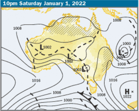
Tropical Cyclone Seth will descend from the north of the state and approach the southeast coast in coming days.
While not directly impacting the coastline, it will generate a powerful 3-4m swell by Monday and will whip up 25 to 35-knot winds (46km/h to 64km/h).
The dangerous conditions will coincide with the peak holiday period, sparking a warning from our beach guardians.
“There are going to be strong side sweeps, flash rips, dumping waves and movement in the water, so it is going to be rough,” the Sunshine Coast’s acting lifeguard supervisor Rowan Simpson said.
“It’s going to be quite troubling if people don’t stick to those red and yellow flags.”
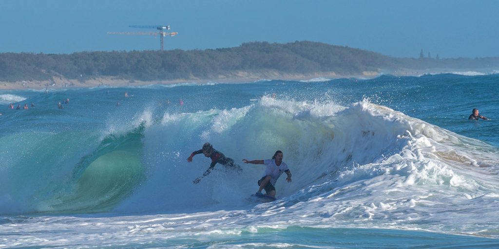
Some beaches could be closed, as thousands of tourists and locals flock to the region.
“It is traditionally one of the busiest times of year,” Mr Simpson said.
“Places like Noosa and Mooloolaba will probably remain open, because they are more protected, but a lot of the open stretch beaches may be closed, depending on how big the swell is.
Mr Simpson said there would be extended patrol hours from New Year’s Eve until Australia Day (January 26), but it was up to beachgoers to be responsible.
He urged swimmers to be vigilant in coming days.
“If you are going down to the beach, please go to waist depth only.”
“Even if you are a good swimmer, your mate might not be and will see you in the water so will go out and they could find themselves in trouble quickly.”
The cyclone should arrive near the Sunshine Coast on Saturday and move south in following days.
“We’ve got ESE winds blowing fairly solidly for the next few days,” Bureau of Meteorology forecaster Michael Paech said.
Local journalists supporting local people. Help keep independent and fair Sunshine Coast news coming by subscribing to our free daily news feed. All it requires is your name and email. See SUBSCRIBE at the top of this article
“Experienced surfers are going to get a good, solid easterly swell, but it will become quite dangerous for swimmers and also for boaties.”
Weather website, Windguru, predicted SSE winds, gusting up to 30 knots (56km/hr), on Sunday, with the swell reaching 3.3m.
Beaches could experience some erosion with the big waves and driving winds combining with a 2.2m high tide on Monday morning.
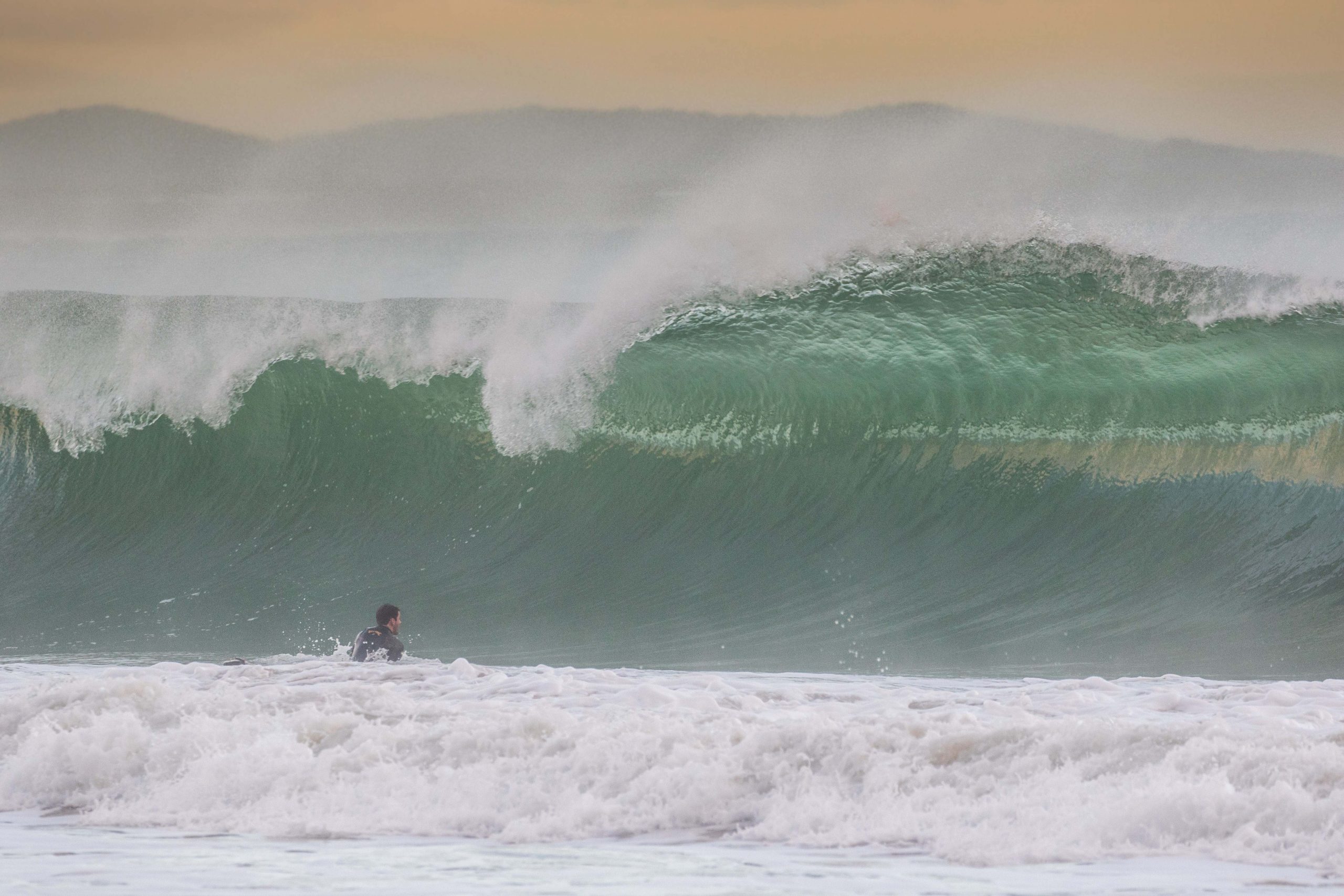
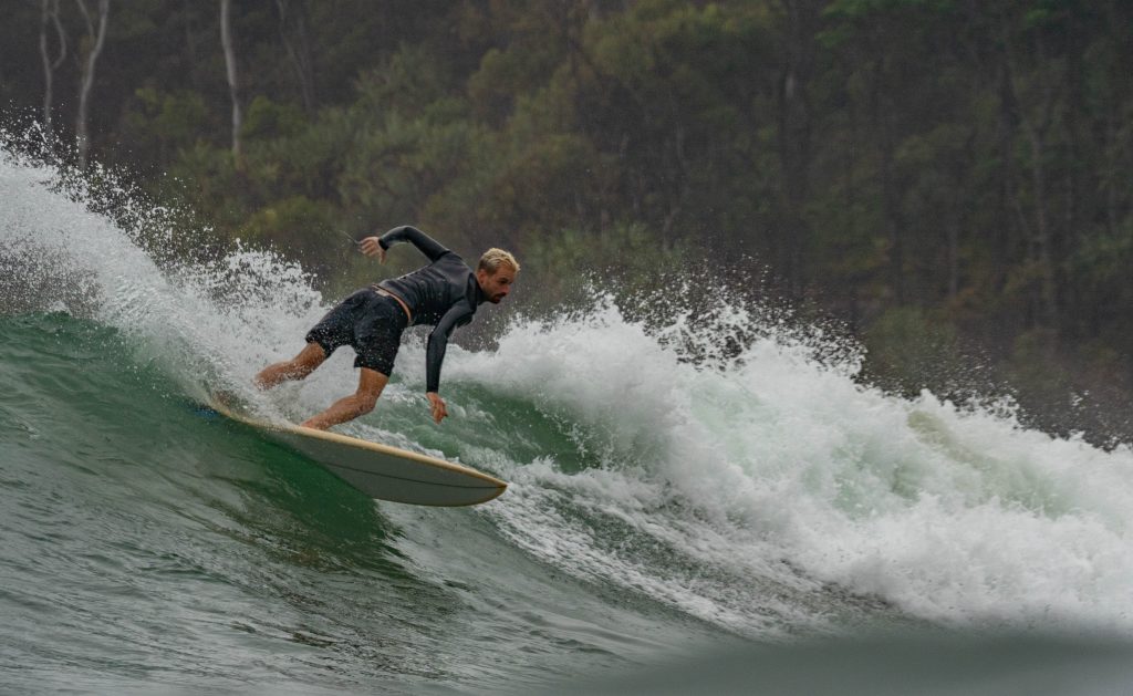
Maroochydore surfing coach Grant Thomas said it should be the most significant swell since winter.
“It’s definitely going to be a biggest swell we’ve had in the last month or two,” he said.
But he said the quality of the surf would be determined by the wind.
“The swell’s coming, and it looks like a solid, east groundswell, which will hit all the points (including Point Cartwright, Alexandra Headland, Noosa Heads and Moffat Beach).”
“But if the system moves to the right place, then we could get offshore winds and we’ll get waves on the open beaches, and everyone will spread out and there will be lots more going on.
“There will be waves up and down the Sunshine Coast and they will be quite large, but they won’t be worth surfing if they’re messy and horrible.
Mr Thomas said the predicted big surf might live up to the hype, but it could also be a fizzer.
“I was speaking to an offshore guy who drives boats through the Mentawais (islands in Indonesia) and he said we might see even bigger surf than what is predicted.”
“But those lows are the hardest things to forecast and there’s been a trend in the last four or five years for people to say a huge swell is going to hit and then it doesn’t.
“Everyone is now going: ‘how good is this going to be?’
“It’s so unpredictable but I’m really hoping the wind can be favourable.”
Mr Thomas, who is the director Maroochy Surf School, said there was usually an increase in swell around the turn of the year.
“This is definitely not the first time we would have had a New Year’s Day swell.”
“A lot of times I have woke up on New Year’s, a bit dusty, and said: ‘oh my God, look at the waves.
“It’s a period when the water’s been warm enough for a while for these sorts of systems to form.”
He said the swell would coincide with an influx of holidaymakers and beachgoers on the Sunshine Coast.
“It’s probably going to be the most crowded week of the year, when everyone has a week off, whether they are tradies or businesspeople.”
Read the day’s top Sunshine Coast News stories sent direct to your inbox once daily. Simply go to SUBSCRIBE button at top of this article to register.
Meanwhile, the Sunshine Coast has been saturated by rain during the past week and Mr Paech said there could be some more to come.
“Picnic Point had 240mm and Sunshine Coast Airport had 211mm during the past seven days,” he said.
“For the next few days, we’re looking at a continuation of those passing showers moving through.
“It might increase on Saturday and Sunday but that’s dependent on how the low moves. The more onshore the winds become the more showers we will get.”
